
Buyer updates
Davao Flood-Risk and Hazard Zone Map: Is Your Property at Risk? (2026)

Table of Contents
Davao City has 265 identified flood-prone sites across three river corridors. Before you shortlist a property, here's how to check flood risk using free government tools and what the historical record actually shows.
This guide is educational and maintained for Davao property buyers, sellers, and investors. For decisions specific to your situation, consult a licensed attorney, accountant, broker, or financing professional.
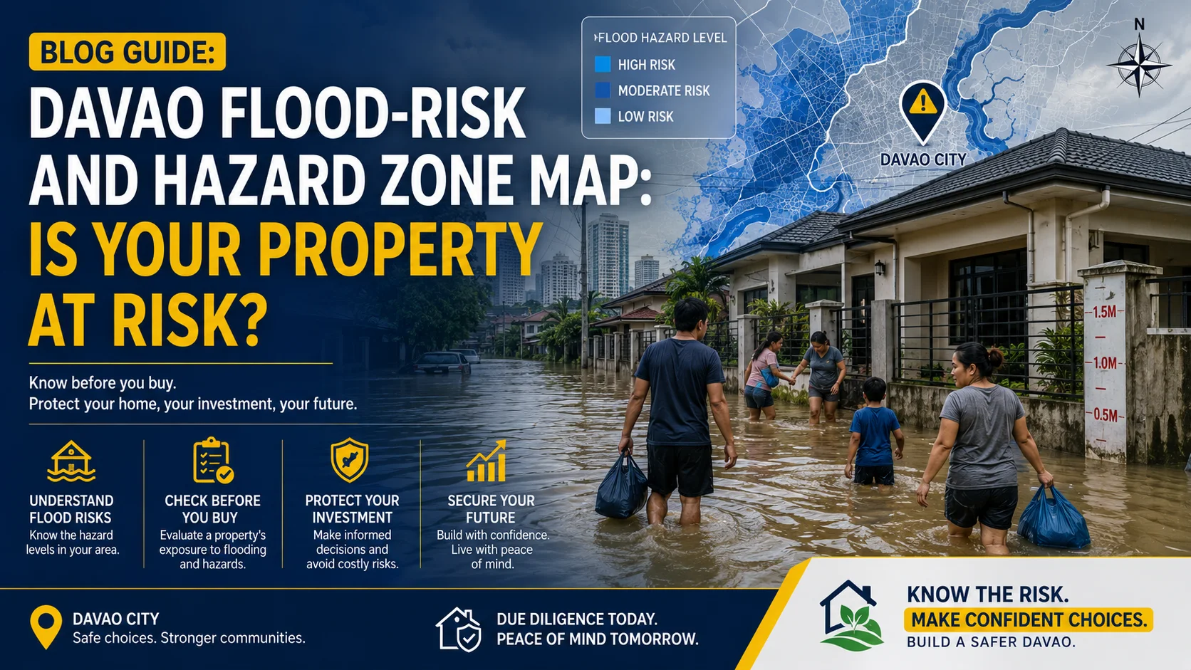
This Is the Check Most Buyers Do Last! If they check at All.
When buyers are shortlisting properties in Davao, most spend their research time on price, location, and developer reputation. Flood risk, if it comes up at all, tends to surface during a property visit, when a neighbor mentions something offhand, or when the buyer notices the ground floor unit sits notably lower than the road. By then, a reservation fee may already have been paid. This guide moves flood risk to where it belongs: before you shortlist, not after you commit. Not because Davao is an unusually dangerous city, it isn't, but because some of its corridors have well-documented flood histories that are a matter of public record, and every buyer deserves to know which ones.
Two Stories Before the Data
The one that went wrong | Noel, jeepney operator, Buhangin Noel bought a second-hand house in a low-lying block near a creek in Buhangin after seeing the property only once, on a dry February morning. The price was good. The seller was straightforward. Nobody mentioned flooding. The following July, the creek overflowed during a sustained monsoon rain. Noel's ground floor was submerged to knee height. His furniture was damaged. His family evacuated for three days. Checking with neighbors afterward, Noel learned it happened most years. Everyone in the block knew. It simply hadn't come up.
The one that paid off | Sandra, teacher, Catalunan Grande Sandra had been shortlisting three properties when a friend suggested she check their flood risk before visiting any of them. She spent thirty minutes on HazardHunterPH, entering each address one by one. Two properties showed moderate flood susceptibility on the government hazard map. One, a house and lot in an elevated part of Catalunan Grande, showed low susceptibility. Sandra visited only that property. She bought it four months later. She never saw the other two in person.
Why Flooding Happens in Davao City
Understanding the cause helps buyers assess risk more intelligently and not just avoid a list of barangays. Davao has lost 95% of its urban wetlands since 1944, from 471 hectares to just 24.46 hectares. High-density residential development and commercial construction replaced tidal marshes, swamps, and natural catch basins that once absorbed rainfall. Many of today's flood-prone areas are literally built on former wetlands and old Davao River riverbeds. The result is a city where heavy rainfall has fewer natural places to go. Davao's flooding falls into three categories: river basin flooding (the most damaging), creek and drainage overflow (moderate), and road-level waterlogging (brief, low-impact). The distinction matters, river basin flooding destroys property, while road waterlogging is an inconvenience that drains in hours. The City Engineer's Office has identified 265 flood-prone areas in Davao City, most of them in District 1, based on data from the City Disaster Risk Reduction and Management Office (CDRRMO). Since 2022, the city government has funded 62 flood control and drainage projects worth ₱608.24 million. Infrastructure investment is ongoing and real. But it addresses symptoms, not the underlying topography. The river corridors that flood today will remain structurally lower than surrounding land regardless of drainage improvements.
The Three Flood Corridors Every Davao Buyer Should Know
1. The Davao River Corridor The Davao River runs through the heart of the city. Low-lying barangays along its banks and in its floodplain have a long and well-documented history of inundation during heavy rain events. A study of the four river systems of Davao City, Davao River Basin, Lasang Watershed, Lipadas Watershed, and Talomo Watershed, found that the top three barangays most vulnerable to a major flood event are Mandug, Lubogan and Tigatto. Barangay Ma-a, one of the ten most vulnerable barangays in terms of flooding in Davao City, is within the Davao River System and has a total area of 1,014 hectares, of which 469 hectares are flood-prone. Jade Valley Subdivision in Barangay Tigatto is one of the most flood-prone areas in Davao City, with residents experiencing recurring floods for over 20 years. In August 2025, residents reported knee-deep floodwaters. Barangays in and around the Davao River corridor that carry documented flood risk include: Mandug, Lubogan, Tigatto, Ma-a, Bunawan, Lasang and low-lying portions of Buhangin near creek systems. What this means for buyers: Properties in these barangays are not automatically uninhabitable. Many residents live there without incident in elevated structures with good drainage. But the risk is real, recurring, and must be factored into any purchase in these areas. Verify the specific lot's elevation and drainage relative to the nearest waterway before proceeding.
2. The Talomo and Matina River Corridor The Talomo and Matina river systems, which is flowing through the city's southern residential core, have become increasingly active flood corridors as upstream development has accelerated runoff. In January 2025, localized thunderstorms caused the Matina River to overflow, flooding Barangays Matina Aplaya, Matina Crossing, and Matina Pangi. Over 617 families (2,211 people) were displaced. Twenty houses were damaged, five completely destroyed. The same areas flooded again. Heavy rains on Monday night, May 18, 2026, triggered flooding in Barangay Matina Pangi, Matina Crossing, Bunawan, and nearby low-lying areas. The Davao City government suspended face-to-face classes and halted work in government offices. The CDRRMO placed the Bunawan River under Code Red, critical level, due to rising water levels. In September 2024, the City Disaster Risk Reduction and Management Office confirmed that affected areas included Barangays Tugbok Proper, Bangkas Heights, Bucana, Matina Crossing, Matina Aplaya, and Talomo Proper. Barangays with documented recurring flood events in this corridor include: Matina Pangi, Matina Crossing, Matina Aplaya, Talomo Proper, Tugbok Proper, and Bangkas Heights.
3. Coastal and Reclamation Areas Along Davao Gulf The city's western coastal barangays face a different but related flood risk: the combination of heavy rainfall and high tides, known as a "king tide" event, can overwhelm drainage systems even without river overflow. The mixture of high tides and heavy rains caused flooding along the Shanghai Creek located in Barangay Matina Aplaya. Reclamation areas along the Davao Coastal Road corridor are built on land that sits at or near sea level. While the Davao Coastal Road project has provided some protection, the CDRRMO noted that the Davao City Coastal Road has helped reduce flooding in coastal barangays previously vulnerable to massive waves during monsoons. Low-lying coastal zones remain structurally exposed to tidal surge in severe weather events. Buyers considering properties in the coastal reclamation corridor should note that this is an evolving area, development is active, infrastructure is improving, but the land's inherent proximity to sea level is a permanent characteristic, not a temporary condition.
The Official Tools: How to Check Any Property?
Three government-backed tools allow any buyer to check flood susceptibility for a specific address or area in the Philippines. All are free. 1. HazardHunterPH: The Most Practical Tool for Buyers URL: hazardhunter.georisk.gov.ph HazardHunterPH is a web application that allows users to quickly and easily generate hazard assessment reports for a selected location. Functions include: finding out if a location is prone to seismic, volcanic, or hydro-meteorological hazards; generating hazard assessment reports with explanations and recommendations; and displaying exposure of schools, hospitals, and roads to various hazards. How to use it: Enter the property address or click the location on the map. The tool generates a report covering flood susceptibility, landslide risk, storm surge exposure, and seismic hazards for that specific point. It is the most comprehensive single-tool check available to buyers.
2. UP NOAH: Flood and Landslide Hazard Map URL: noah.up.edu.ph/know-your-hazards Upon landing on the website, a user can type a location or click "Your Current Location." The site then generates a map of the selected location and tells the user the flood, landslide, and storm surge hazard levels of the area. UP NOAH's maps are scenario-based models, particularly useful for understanding how a location performs under heavy rainfall conditions. The interface is straightforward and accessible to non-technical users.
3. PAGASA Flood Hazard Maps URL: pagasa.dost.gov.ph/products-and-services/flood-hazard-maps PAGASA publishes official flood hazard maps for Philippine municipalities and cities, including Davao. These are deterministic models designed for long-term planning, useful for confirming what HazardHunterPH and UP NOAH show for a specific area.
Due Diligence Checklist: Flood Risk Edition
Use this before shortlisting and not after visiting. Digital checks (do these first):
- Run the property address through HazardHunterPH (hazardhunter.georisk.gov.ph)
- Cross-check on UP NOAH (noah.up.edu.ph/know-your-hazards)
- Check if the barangay appears on the CDRRMO's documented flood-affected list, search "[barangay name] + flood + Davao CDRRMO"
- Check Google Maps satellite view for proximity to rivers, creeks, or coastal zones
On-site checks (do these during property visit):
- Ask barangay staff or the barangay captain directly: "Has this area flooded in the last five years?"
- Ask at least two neighbors, not the seller, the same question
- Note the property's floor level relative to the road and nearest waterway
- Look for water stain lines on perimeter walls or gate posts, a reliable indicator of past flooding depth
- Check whether ground floor units sit below, at, or above road level
- Assess drainage direction, does the street drain away from or toward the property?
A Note on Risk and Perspective
This article names barangays and flood events honestly because buyers deserve that information. But naming a barangay as flood-prone is not the same as saying no one should buy there. Flood risk in Davao is a spectrum. Some areas flood severely during major weather events but are otherwise stable. Some flood briefly at street level during any monsoon rain and drain within hours. Some flood rarely but catastrophically when they do. The risk profile, the specific lot's elevation, the building's construction, and the buyer's risk tolerance all determine whether a purchase in a higher-risk area is sensible or not. What this guide argues and what the evidence supports is that buyers should know the risk profile of an area before they commit to it. Not after. Thirty minutes of hazard map research is the minimum standard. Talking to existing residents is irreplaceable. And in areas with documented river basin flooding history, an independent elevation assessment and structural review is worth the cost.
Related reading
buying_guide
The Complete Guide to Buying Property in Davao, Philippines (2026)
Planning to buy property in Davao? This guide covers everything from financial readiness to title transfer—written for first-time buyers, OFWs, and investors who want to make confident decisions.
buying_guide
Condo vs. House and Lot in Davao: Which Is Right for You?
Torn between a condo and a house and lot in Davao? This honest comparison covers total cost of ownership, lifestyle fit, and long-term value , with a clear decision framework at the end.
market_update
Davao Real Estate Market Overview (2026): What Every Informed Buyer Needs to Know
Davao's property market has been quietly outpacing many Philippine cities. Here's an honest, area-by-area look at what's driving demand, which corridors are emerging, and what it means for buyers in 2026.
buying_guide
OFW Property Buying Guide: How to Purchase Property in Davao from Abroad (2026)
Thinking about buying property in Davao while working abroad? This definitive OFW guide covers the Special Power of Attorney, remote due diligence, Pag-IBIG eligibility, and how to do it safely.
market_update
Step-by-Step Guide: How to Verify a Land Title in the Philippines (2026)
Never rely on a photocopy. Here's the exact step-by-step process for verifying a Transfer Certificate of Title or Condominium Certificate of Title in the Philippines and what red flags to watch for.
Flood risk data referenced in this article is drawn from CDRRMO reports, SunStar Davao, MindaNews, and published research as cited. Hazard susceptibility is assessed using government-mandated tools like HazardHunterPH, UP NOAH and PAGASA, which are updated periodically. Always verify current hazard assessments using these tools before making any property decision. This article is for educational purposes only and does not constitute professional risk assessment or legal advice. © 2026 MM Properties Davao. Last reviewed: June 2026.